
Poradnik do gry „ Imperium Romanum” zawiera zbiór zasad oraz metod na najlepszy i uniwersalny rozwój ekonomiczny, dla niemal każdej mapy dowolnego scenariusza jak i kampanii historycznej, a także taktyki wojenne oraz informacje podstawowe. Imperium Romanum - poradnik do gry zawiera poszukiwane przez...

Commercial relations between Arabs and Slavs
5.00 / 5.00
- Wydawca:
- Wydawnictwo Akademickie Dialog
- Kategoria:
- Literatura faktu, reportaże, biografie
- Język:
- polski
- ISBN:
- 978-83-8002-351-2
- Rok wydania:
- 2015
- Słowa kluczowe:
- angielsku
- arabs
- autor
- between
- commercial
- middlemen
- monograph
- najwcześniejszym
- napisana
- relations
- slavs
- stosunków
- world
- zbadane
- źródła
- mobi
- kindle
- azw3
- epub
Jeżeli nie widzisz powyżej porównywarki cenowej, oznacza to, że nie posiadamy informacji gdzie można zakupić tę publikację. Znalazłeś błąd w serwisie? Skontaktuj się z nami i przekaż swoje uwagi (zakładka kontakt).
Kilka słów o książce pt. “Commercial relations between Arabs and Slavs”
Napisana po angielsku monografia dotyczy stosunków słowiańsko-arabskich w najwcześniejszym okresie (IX-XI w.). Autor wykorzystuje mało zbadane źródła muzułmańskie, arabski i perskie. A monograph dealing with the trade relations between the Slav World and the Arabs. The reader is confronted with a mass of information on the middlemen of trade and commodities, which were exchanged.
Polecane książki

Maria De La Torre jest twarda i zdołała ocaleć. Jej Życie nie było usłane różami, ale krwią i poświęceniem. W Trylogii namiętności towarzyszy swojej duchowej siostrze Gillian, ale ta opowieść jest o jej życiu. Tym, które wybiera i które ktoś, kto wrócił z przeszłości, p...

Jadwiga po stracie męża musi sama zająć się wychowaniem piątki dzieci i utrzymaniem domu. Pocieszenie znajduje w małych przyjemnościach: tworzy piękne róże z bibuły. Za namową kobiet spotykających się w dworku zapisuje się na kurs florystyczny. Czy uda jej się zrealizować marzenia i odnaleźć spokó...

Czekaliśmy na nią. Rysowaliśmy ją. Śniliśmy o niej. Chcieliśmy latających deskorolek, antygrawitacyjnych samochodów, równości i szczęśliwości.
Ona nadeszła.
Pięć opowiadań Bartka Biedrzyckiego, autora sprawnie poruszającego się pomiędzy postapokalipsą a utopijnym podbojem kosmosu, si...

W niniejszym wydaniu połączono dwie książki, nadając im wspólny tytuł. Bramy milczenia stanowią rodzaj wprowadzenia, Erem zaś rozwija właściwą problematykę pustelni w nawiązaniu do trzech biblijnych symboli: pustyni, góry i świątyni. Napisane prostym językiem zrozumiałym dla dzisiejszego człowieka, ...
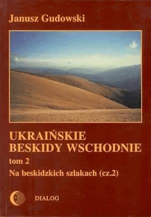
Kontynuacja cyklu zapoczątkowanego Monografią krajoznawczą Ukraińskich Beskidów Wschodznich i pierwszą częścią przewodnika. Kolejny tomik zachęca do wędrówek po takich szlakach, jak: Beskidy Pokuckie, Bieszczady Wschodnie, Swidowiec, Połonina Krasna, Borżawa i po beskidzkich szlakach w...
Poniżej prezentujemy fragment książki autorstwa Ahmad Nazmi
Ahmad NazmiCOMMERCIAL RELATIONSBETWEENARABS AND SLAVS(9th–11th centuries)Wydawnictwo AkademickieDIALOGWarszawa 2015Editor: JANUSZ DANECKIPublication subsidized by KBN – State Committee for Scientific Research© by Wydawnictwo Akademickie DIALOG, 1998ISBN e-pub 978-83-8002-351-2ISBN mobi 978-83-8002-355-0Konwersja: eLitera s.c.ContentsBook InfoDedicationPREFACESURVEY OF SOURCESGeographical sourcesTravellersHistory and chroniclesOther sourcesCHAPTER ONE: THE WORLD OF COMMERCEIslamic component in the realm of tradeCommercial world of the MediterraneanEconomic competition between the two powers – contradiction between two policiesThe Khazar-Arab conflictCHAPTER TWO: ARABIC KNOWLEDGE OF THE SLAVS (AṢ-ṢAQĀLIBA)The term “Ṣaqāliba” – its meaning and etymologyThe question of the Ṣaqāliba in Muslim SpainGeographical location of the Ṣaqāliba (Ṣaqlaba)Peoples affiliated withor related to the SlavsThe Rūs/ Ar-RūsiyaThe BulḡārCHAPTER THREE: THE MIDDLEMEN OF TRADE1. Jewish merchantsThe Jewish communitiesRadanitesThe Khazar merchants2. The Rūs merchants 3. The Bulḡār merchants Geographical location of the town of Bulḡār 4. Muslim merchants CHAPTER FOUR: COMMERCIAL EXCHANGE AND TRADING COMMODITIES1. Slave trade System of slavery in the Muslim societyThe origin of the slaves in the caliphateSlave huntersMediators and brokersMuslim slave markets 2. Fur trade3. Other commoditiesCHAPTER FIVE: TRADE ROUTES Northern routes Axial routesSamkirš Tmutarkan (Matarha ) SarkelCHAPTER SIX: THE MONETARY QUESTION The monetary question in the caliphateSources of precious metalsThe monetary question in European regionCONCLUSIONANNEXESRevenues of he caliphate at the beginning of the ninth century AD according to the list of Al-ǦahšiyārīDates of the principal authors and sourcesFig. no. 1: The seven climes according to Al-Bīrūnī and YāqūtFig. no. 2: The seven climes according to YāqūtFig. no. 3: The Globe (Kūrat al-arḍ) according to Kitāb Iẖwān aṣ-Ṣafā wa-ẖullān al-wafā’Fig. no. 4: The seven climes according to Šams ad-Dīn ad-DimašqīFig. no.5: The World Map according to YāqūtMap no. 1: Peoples of Eastern Europe Map no. 2: Main commercial centres in Eastern Europe. 10th-11th centuriesMap no. 3: Trade routes between the caliphate and Eastern EuropeBIBLIOGRAPHYFOOTNOTES
Dedicated to the memoryof Tadeusz Lewicki and Józef Bielawski
Preface
Many scholars who have a profound knowledge of Arabic and other Oriental languages have written numerous works which touch directly or indirectly on Muslim civilization, its history, culture and the vicissitudes of the caliphate.
The scholars who have undertaken research into the history of the caliphate have employed the Muslim historical literature of this age. Some of them have taken an interest in the economic history of various periods throughout the Middle Ages. The works of Muslim geographical literature constitute a representative branch of Muslim and Arabic Medieval literature and contain, additionally, many accounts of Muslim activities in the field of trade.
The main aim of this study is to present through selected texts the major Muslim works of geographical and historical literature which deal with the matter of trade with northeastern Europe during the period from the 9th to the 11th centuries. There is an abundance of texts referring to the social and economic life during this period in general and the commercial life, types of merchandise and trade routes in particular which have been studied and analyzed from the literary and historical point of view.
This study not only presents texts and accounts mentioned in Muslim sources but also sheds light on the history of trade between the caliphate and these European regions. In order to make these sources more informative, it was necessary to carry out a comparative study between these sources so that a common reference point in the geographical and historical data of this époque could be found.
Most of the works on the economic history of the caliphate have dealt with the materials in a general manner or have been restricted to a study of the regional economic history. The study of economics in the Middle Ages in Islamic world and elsewhere has inevitably led to the question of trade. In the matter of commerce and foreign trade, much important research has focused on Muslim trade with the Far East (India and China). As far as commercial exchanges between the caliphate and the Occident are concerned, also many works have been written. Generally, one might comment that some excellent studies have been written using the data gleaned largely from selected Muslim sources. The work of F. Heyd entitled Histoire du Levant au Moyen-Age is considered as one of the first major books which studied the commercial relations between the East and West. Undoubtedly, in many chapters of this work, the author based his conclusions indirectly on Muslim sources, but solely on those translations which were available at the end of the 19th century. His work also covered a long period extending from the 6th to the 14th centuries. Another work contemporary to Heyd’s study was published by the German scholar G. Jacob in the year 1887 under the title of Nordisch-baltischer Handel der Araber. Although this work is devoted to Muslim trade with Europe during the early Middle Ages, the author had the tendency to place more importance on trade with the Germanic sphere. Jacob also utilized to a broad extent the Muslim sources available at this time. In Poland in 1909, A. Szelągowski published his work Drogi z Polski na Wschód which studied the commercial routes linking Poland with the East during the Middle Ages. His work was also written in the light of Byzantine and Muslim sources available in most European languages and with the aid of additional research. After the First World War, A. Mez furnished valuable research under the title of Die Renaissance des Islam (1922) by paying more attention to these Muslim sources. In general, his work was written on the subject of Muslim civilization, but he referred to the social and economic situation of the Caliphate and pointed out the commercial field of interest.
An early study on such sources was presented by J. Lelewel, entitled Géographie du Moyen Age (1852) which included Latin and Arabic geography. After the Second World War, Polish scholars have worked in the field of Muslim geographical literature. Since the time of T. Kowalski, many of these sources have been researched through translation and commentary. In 1946, the chapter on the Slavs in the work of Al-BakrI was translated and commented on by T. Kowalski in a study under the title of Relacja Ibrāhīma Ibn Ja‘kūba z podróży do krajów słowiańskich w przekazie al-Bekriego. In the year 1949, T. Lewicki published his work entitled Świat słowiański w oczach pisarzy arabskich. T. Lewicki, carrying out a series of studies, presented many of the selected texts from Muslim geographical works which covered the field of Slavonic history in general. These works, Źródła arabskie do dziejów Słowiańszczyzny were published successively in three main volumes including Arabic texts with translations into Polish and supplemented by comments of a scholarly and comparative nature; the fourth volume contains an index which covers all of this study. Many other essays and monographs were also supplied by the author in the same field. Following the same trend, M. Kowalska presented her work entitled Średniowieczna arabska literatura podróżnicza (1973) which generally came to be a study on Muslim travel literature covering a long period extending from the 8th century up to the 16th century. A part of Kowalska’s work sheds light on the activities of travellers who visited the Slavonic countries or on those whose works touched on this matter, such as Hārūn Ibn Yaḥyà, Ibn Ya‘qūb, Ibn Faḍlān, and Abū Ḥāmid al-Ḡarnāṭī. Other Polish orientalists participated in these studies from different points of view, such as the works written by A. and F. Kmietowicz and M. Czapkiewicz in the field of numismatics and especially Muslim coins discovered in Poland.
E. Ashtor in his work A Social and Economic History of the Near East in the Middle Ages studied the economic structure of the ‘Abbāsid empire as a whole, including agriculture, industry and trade. He also pays attention to the demographical growth, technological progress, foreign trade, expansion of Muslim gold and monetary problems during the Umayyad and ‘Abbāsid periods. After a series of research studies on the commerce of the Middle Ages, M. Lombard published his work entitled L’islam dans sa première grandeur, translated into English as The Golden Age of Islam. This work dealt in detail with trade and commercial routes, monetary movement, the direction of urban evolution, economic developments in Muslim regions, production and trading commodities and with the commercial interchange within and beyond the Muslim countries during the Middle Ages.
Much other research in the field of the economic history of the Muslim caliphate has been published within the last several years, some of it is of use directly or indirectly to this study.
This work consists of five main chapters, a preface, an introductory chapter and a conclusion. There is a bibliography of quoted sources as well as a number of figures and maps serving to elucidate the text. An annex containing Arabic texts with English translations is planned to be published in a separate volume.
It was necessary to begin this work by collecting the data relating to the subject. The research presented here is primarily based on Muslim and Arabic sources written during the period of the 9th, 10th and 11th centuries. Other sources which were compiled later have also been used because of the original information contained in them or because they can be used as a replacement for other missing works. Some of the texts in the annex are directly connected with the matter of trade relations with Europe; others may be considered as touching only indirectly upon the subject but these have been selected because of their overall importance. A verbatim translation is also supplied in addition to the original Arabic text.
It was also necessary to examine and investigate this data in conventional terms. This has been done by means of a descriptive, historical and comparative study of the sources. They have been presented and arranged in chronological order in the chapter devoted to the survey of sources. Analytic research on these sources can be found in the other chapters of this work. For this study, the geographical sources are of highest priority, therefore I have devoted special attention to them; next come the travel books, and finally historical and literary works.
* * *
The first chapter deals in general with the influence of Islam on the economy of the caliphate and with the Islamic component in the realm of commerce in particular. Here it became inevitable to discuss the problem of trade in the Mediterranean world with the coming of Islam in the light of the Pirenne theory. Finally, the economic competition between the Byzantine Empire and the caliphates on the one hand and the Khazarian-Arab conflict on the other are discussed the latter conflict is considered because it can be placed within the framework of trade controversy between these two main powers.
The second chapter contains a philological study of the main terms and names, their meanings and etymology which are not yet agreed upon. Additionally, the geographical point of view of the Muslims towards the northeastern regions of Europe and the peoples inhabiting these regions is furnished here.
The third chapter deals mainly with the middlemen of trade, including the Jewish merchants and the role played by their communities, the Radanites and the Khazar state. Rūs, Bulḡār and Muslim merchants and their trade activities between Muslims and northeast Europeans are also focused on in this chapter.
The fourth chapter is allocated to the commerce and the commodities traded between the Muslim countries and Europe, including the slave trade as the main transaction undertaken during this period. The origin of slaves, the mediators and brokers of this trade and the slave markets is taken into consideration. Other sections of this study have been earmarked to discuss the fur trade and other items of trade including raw materials and manufactured goods.
The last chapter deals with two main points, the first being the main trade routes linking the Muslim countries with eastern and central Europe and other axial roads. It was also necessary to mention here some main trade centers and enterpôts lying along these roads. The second point is a discussion of the monetary question in the Muslim lands and in Europe, which was also involved in this trade.
At the conclusion of this study, an outline is provided which summarizes the entire work, although a brief conclusion has also been included at the end of each chapter.
As mentioned, a few diagrams and maps have been attached to this work; some of them have been taken from old Muslim geographical sources, other, especially the maps, have been compiled with reference to these sources. All figures and maps can be found at the end of this study.
The book was conceived as a continuation of my studies begun by a PhD. thesis prepared in the Oriental Institute of the University of Warsaw under the supervision of Professor Janusz Danecki. The original idea has been enlarged and many aspects of the discussed problems are here presented in a new light. In a number of instances, however, the difficulties of obtaining important publications pertaining to my subject made it impossible to update some marginal questions. I still do hope to have presented in my monograph a clear picture of the commerce between the two important worlds.
Many persons have helped me in preparing this monograph. I owe much to the experience and knowledge of Professor Janusz Danecki. I am indebted to Ms. Amy Kahler and Ms. Teresa Opalińska for their patience in correcting my English. Finally, I would like to express my appreciation to Boguslaw R. Zagórski for his assistance in obtaining a number of important publications and introducing a uniform transliteration of Arabic. Needless to say that I am, of course, solely responsible for any shortcomings in this work.
Survey of sources
Geographical sources. Travellers. Historical materials and chronicles. Other sources
The majority of sources analyzed in this work has already been studied and commented on, even translated to many other European languages in order to be made available to scholars of various fields. This does not necessarily mean that they have been properly assessed or that they have lost their originality for subsequent studies. Undoubtedly, a further investigation into this subject aided by recent scholarly studies may prove to be a profitable reconsideration.
Beside the geographical and historical materials that compose the main portion of our sources, other literary works will be used to document our subject. Among these, Arabic biographical dictionaries provide universally valuable data about the tradesmen as a part of biographical information. These works sometimes contain anecdotes related to trade affairs. Not only do they provide details on the names and itineraries but also contain useful knowledge on the economic life of that time.
In general, I shall adopt the Muslim materials which touch on the subject, dividing them into three main types – the geographical, historical, travellers’ accounts and general works of literary character.
Geographical sources
It can be said that it was not before the coming of the ‘Abbāsid rule that the Muslims began to write their geographical works which only later came to be highly valued in Arabic literature. It seems that Indian and Persian geographical literature was the first to reach the caliphate. Most probably Indian influences were important and traditionally are considered as the main factor in the birth of Arab astronomy as well as Arab geography and cosmography. Soon thereafter Greek geography and astronomical knowledge gained the upper hand in the Muslim world and subsequently in geographical works[1]. It was by translating the main Greek geographical works, which helped the Muslims glean much of their major information on the geographical configuration of the world, thus dividing it into inhabited and uninhabited parts and distinguishing seven different world climes.[2]
The beginning of the ninth century saw the first serious geographical reports written in the Arabic language. Most of them were derived from or largely dependent upon Greek sources, particularly on the geography of Ptolemy[3].
Muslim geographical materials comprise the main portion of the information covered in this study. Many of these materials were based on govern-mental documents; their authors, as we shall see below, held high offices in the administration of the Muslim state. This material in many cases replaces the missing archives. According to recent research there is a considerable mass of geographical literature in Arabic. The earliest examples of it derive their origin from the administrative necessities connected with the vast Muslim empire.[4]
The materials which present apparently precise and important data on economic and commercial affairs belong to the epoch covered by my study. In other sources there is information coming from earlier materials either Arabic or Greek, Byzantine. The compilers of these materials also recorded many accounts which they received from trustworthy people: merchants and travellers or even from Muslim prisoners who were captured during the war between the Muslims and the Byzantines and spent a long time outside the Muslim domain.
In general, the geographical works contain rich data on Muslim trade, international commercial traffic and listings of merchandise. At any rate, the value of these Muslim geographical materials is either due to their antiquity and proximity to the described events or to the fact that they use other con-temporary works which no longer are extant[5].
It has been rightly concluded that almost every geographical work contains some historical data on the country or the region under discussion. This is of course very useful for the study of the relationship between these regions and the Muslim countries, particularly in the light of their commercial ventures.
Al-H̱uwārizmī, d. between 220-240H/835-855
About Abū Ǧa‘far Muḥammad Ibn Mūsà al-H̱uwārizmī’s birth we can say nothing. He probably died at the middle of the ninth century. He was known primarily as a mathematician and philosopher. He was also one of the members of the research team founded during the reign of the caliph Al-Ma’mūn to conduct various scientific experiments and studies in Dār al-Ḥikma (The Abode of Wisdom)[6]. This team was responsible for astronomical experiments, geodetic operations and the measuring of the length of a terrestrial degree[7]. He was the compiler of many works on astronomy, mathematics, mechanics, history and geography. It is quite obvious that he was more famous as an astronomer and mathematician than as a geographer[8]. It remains relevant however to speak about his geographical work Ṣūrat al-arḍ (The image of the Earth). Apparently, Al-H̱uwārizmī based his work on Ptolemy’s Geography which was already translated twice into Arabic[9]. It seems that he was not content with merely translating Ptolemy; he also incorporated into his version many corrections, and added more information derived from several previous Arabic and Persian geographical studies[10]. According to Kračkovskij, the work of Al-H̱uwārizmī is not a direct translation. It is considered to be a rearrangement of Ptolemy’s data with the addition of other contemporary information and the knowledge acquired by the Arabs[11].
Some of the information mentioned in Ṣūrat al-arḍ relates to a description of Europe which is categorized under the fifth, sixth and seventh climes[12]. Accordingly, the author considered the countries of G.rmānīa as the land of the Ṣaqāliba and located it at a latitude of 36o40 and a longitude of 52o0. He also put the countries of S.rmāṭīas, the land of the Burǧān, at a longitude of 73o0 and a latitude of 59o30[13]. Apparently, he had Ptolemy’s astronomical tables revised on the basis of simultaneous observation. Other names and localities mentioned here are unfortunately distorted and unrecognizable.
As it is well established that a great portion of this data was founded on Ptolemy, it already seems to be outdated by at least five centuries. This matter clearly explains the undercurrent of conflict between the theoretical concepts of the Greeks knowledge on the one hand and the practice and observation of the Muslim merchants and travellers on the other hand.
On the point of trade, Al-H̱uwārizmī’s work has not brought to light any valuable information. Apparently his work was not a work of economic or human geography, but rather a scientific one. In another purely mathematical work, namely Kitāb al-ǧabr wa-al-muqābala, the author mentioned (in the introduction to this work) that he composed the book specially for trades-men and for the surveying and measurement of land[14].
It would not be entirely wrong to say that before the time of Al-H̱uwārizmī, Muslims were themselves able to write a scientific geography in a true sense.
Similar to the work of Al-H̱uwārizmī, but of a later date, is the work of Suhrāb entitled ‘Aǧā’ib al-aqālīm as-sab‘a (The wonders of the seven climes). Nothing is known about the author, there is even uncertainty about his real name amongst scholars. He is also known by the name of Ibn Sīrābiyūm; most probably his work was compiled more than fifty years after the death of Al-H̱uwārizmī[15]. At first glance we can only be fairly certain that there are no large differences between the work of Suhrāb and the former work as far as the material adopted from Ptolemy is concerned.
The main difference is to be found primarily in the part of information acquired from other Muslim geographers. Both authors faithfully complied with the Greek system of the seven geographical climes. Moreover, the second author gave the name of this system to his work[16].
Ibn H̱urradāḏbih, d.300/912
Abū al-Qasim ‘Ubayd Allàh Ibn Aḥmad is one of the earliest Muslim geographers and the author of Kitāb al-masālik wa-al-mamālik (The book of countries and routes)[17].
His position was that of a supervisor of postal affairs and intelligence in the province of Al-Ǧibāl and then he was the head of the same departments in the caliphate. This helped him collecting most of the geographical materi-al for his work[18]. It has been rightly suggested that Ibn H̱urradāḏbih’s work should be considered as pioneer material in the field of so-called administrative geography. This is due to the nature of the writer’s office as well as his administrative and practical style of his writing and reporting[19].
As his book is an official itinerary, it gives precise information and good data on the world in his times-not only on the caliphate but also on non-Muslim countries and other regions. In addition to the knowledge acquired in his office, it seems that he had a wide scale of other information based on sources. The geographical heritage of the Greeks was apparently used by him. In the preface to his work he states that he had translated Ptolemy’s Geography from a foreign language, perhaps for his own use and therefore it never became known[20].
Recent scholarship confirms de Goeje’s argument that Kitāb al-masālik wa-al-mamālà for the first time was written in the year 232/846, and then completely revised in the year 272/885. The version used for this study is an abridgment of the original[21]. But the fact that Al-Muqaddasī, who wrote about one hundred years later, regarded Ibn H̱urradāḏbih’s work as being too brief to be of much use, faces US with an incongruity of debatable questions[22]. Either he did not read the complete work of Ibn H̱urradāḏbih or the extant summary was the only work composed by the author. Concerning the data mentioned in this work, Kračkovskij divided it into two main groups bearing distinctive characteristics. The first consists solely of rough official records of great importance, the second contains a description of geographical marvels. These two divisions render the work disharmonious as a whole[23]. Nevertheless, it became one of the main geographical sources and created a pattern followed by later Muslim geographers.
The material examined here is by no means confined to the Muslim world; rather it includes the non-Muslim regions reaching as far as the author could obtain information. One chapter he devoted to Byzantium and the routes linking it with the Muslim lands. Other scattered information on Slavs, Bulḡārs, Burǧāns, Rūs, Khazars and other European peoples can be found in his work. The most important peculiarity in his book is certainly the two chapters which contain special references to the Jewish merchants namely Ar-Rādāniyya and to the Rūs merchants[24]. Most probably these accounts did not exist in any other previous sources. As far as it is known, there are no other Arabic texts which have been studied and investigated as extensively by recent scholars as Ibn H̱urradāḏbih’s text. These two reports among orientalists are considered to be one of the most important documentation containing references to international medieval trade. It should be pointed out that some western scholars maintain that the above statements were probably later inserted into the original work of Ibn H̱urradāḏbih. Whatever the answer to this controversial problem may be and whether the texts were inserted by the author or by someone else, their importance to the study of commerce in the medieval history remains valid[25].
Other information on revenues, taxation, and main products of all Muslim provinces and even information on the Byzantine Empire and other non-Muslim regions can be obtained from this work.
Ibn H̱urradāḏbih’s geography is considered to be the first independent geographical treatise in Arabic in the form of road books in which itineraries, economics and commerce occupied a prominent place[26].
Al-Ya‘qūbī, d. between 284-292/897-905
Aḥmad Ibn Ya‘qūb Ibn Ǧa‘far Ibn Wadih, who was also known by the kunya Al-Ya‘qūbī[27], chronologically followed Ibn H̱urradāḏbih. He was known as a historiographer, but he also wrote in the field of geography. His work entitled Kitāb al-buldān (The book of countries), was transmitted in an incomplete version.
According to the biographical information about him, Al-Ya‘qūbī was born in the family of an official. His father and grandfather served in governmental administration as head of the post (barīd). Most probably he also held an office in the caliphate[28]. In the preface to his work he states: “I set out young in years and ever since have been travelling in foreign countries, and when I would meet somebody from these countries, I usually asked him about his homeland, its production, what the people there dressed, their religions, the distances between places and the principal roads I have worked long on this book; I have gathered information on the spot and I have checked my information by interviewing reliable witnesses”[29].
In fact, Al-Ya‘qūbī’s book follows the example of Ibn H̱urradāḏbih’s text, but it is not another version of the earlier works. This work is to a great extent based on the author’s own observations and experiences.
It seems that the author restricted his main geographical observations to the Muslim world, giving more attention to Baḡdād and the Mesopotamian region, Persia, and the holy lands. He also devoted some parts to North Africa and the Al-Andalus. Much information on Europe can be found scattered throughout the text.
Ibn al-Faqīh, wrote 290/903.
Little is known about this author who, according to Yāqūt, is known as Aḥmad Ibn Muḥammad Ibn Isḥāq al-Hamaḏānī. He is also referred to as Abū Bakr Aḥmad Ibn Muḥammad al-Hamaḏānī[30]. He wrote a book of some one thousand pages in the year 290/903 entitled Kitāb al-buldān (The book of the countries). He gathered information for it from other books and mainly based it on Al-Ǧayhānī[31]. The extant text is an abridged version prepared by a certain Abū al-Ḥasan ‘Alī Ibn Ǧa‘far aš-Šayzarī[32]. Most probably the section devoted to each country, region, and town was defined by the editor of the abridged version.
Actually, due to this abridgment, Ibn al-Faqīh’s work pays no attention to real geographical matters; his work is a mixture of disarranged material including literary themes, anecdotes, historic marvels and some geographical data. It seems that he did not follow the pattern of former geographers. For instance, he attaches no importance to itineraries, the regional borders, products and economic information. It is not astonishing that Al-Muqaddasī, a geographer of the tenth century, severely criticized Ibn al-Faqīh’s work, saying: “Ibn al-Faqīh has his own way of writing, he only mentions the big towns, but says nothing about regions and provinces; he inserts into his work nonsensical material; all of this depending on his mood, he passes from the serious matters to entertaining, from jest to seriousness…”. About the author’s sources, Al-Muqaddasī states that Kitāb al-buldān is similar to Kitāb al-amṣār by Al-Ǧāḥiz, most probably the former, if he did not directly borrow from the latter, was most certainly influenced by him[33].
We may thus conclude that the geographical information in this work is of secondary importance. It gives very scarce data on the world outside of dār al-islām, moreover much of the data is overstated. Perhaps the most useful aspect of this study is the information of the two texts of Ibn H̱urradāḏbih on Jewish and Rūs merchants[34]. The author follows his predecessor, nevertheless there is no complete correspondence between the two accounts. However, he sheds some more light on the problem of the Radanites and the Rūs in the history of medieval trade; but this created a long controversy among scholars, as will be shown in the following chapters. Although the author neglects trade matters in his work, he devotes many pages written in a prosaic style to the discussion of the Muslim tradesmen.
An original part from Ibn al-Faqīh’s work Kitāb al-buldān was discovered in Mašhad and published in Russia by M. Chitishvili. This part is devoted to the revenues from the Iraq and Ṭabaristān and it shows deep interest in the economic situation of these regions[35].
Leaving aside Al-Muqaddasī’s digressions, recently some scholars asserted that this work provides a very important contribution to the history of the human culture during the times contemporary to the writer[36].
Ibn Rusta, d. between 310-337/922-948
Abū ‘Alī Aḥmad Ibn Rusta compiled an elaborate work entitled Al-A‘lāq annafīsa (The precious objects) of which only the seventh volume has survived. Most probably he wrote his work between the years 290-903/903-913[37].
Among the authorities he cited, there is mentioned Muḥammad Ibn Kaṯīr al-Farḡānī’s book Kitāb al-fuṣūl – selection from the Almagest, and Abū al-Faraǧ Aḥmad Ibn aṭ-Ṭayyib as-Saraẖsī who wrote a geographical work about routes and countries entitled Kitāb al-masālik wa-al-mamālik[38].
Ibn Rusta’s work contains an introductory chapter on the image of the world based on astronomy and Greek cosmography as well as many descriptive chapters on regions and countries. One can find in his work a great deal of materials dealing with many regions outside the Muslim domain. His chapter on the Byzantine empire, Constantinople and Rome included interesting accounts which probably were related by Hārūn Ibn Yaḥyà who was in captivity in Byzantium for a long time[39]. There can also be found some original details on the Longobards, Burgundians, southern Slavs from the Balkans and other European peoples. After the chapter on India, he devotes other chapters to the Khazars, Slavs, Rūs, Burṭās, Bulḡārs and Magyars.
Ibn Rusta’s work is probably one of the first studies dealing with peoples from outside dār al-islām in such an intense manner. His information on the Slavs, Bulḡārs, Rūs and Magyars stands out as original and valuable data[40]. His details about the Khazars and the Bulḡārs are written slightly earlier than those of Ibn Faḍlān. Recently scholars came to the conclusion that Ibn Rusta wrote his work, between the years 290-300/903-913[41]. Hence, it is not entirely correct to state that Ibn Faḍlān was one of Ibn Rusta’s main sources on the Khazars and subsequently the Bulḡār matters as assumed by Marquart[42].
His accounts on the Rūs or Ar-Rūsiyya, as he prefers to call them, stands in favour of the Normanist school and their theory on the ancestry of the Rūs. He describes the land of the Rūs as a damp island from whence they launched their ships to attack the Slav people.
The chapter on the Slav people has attracted the attention of many specialists, in particular historians and Slavists. His account on the town of the Slavic king is very interesting. He also earmarks some information on the habits of the Slavs, their way of life and quotes some words which apparently derive from their Slavonic language[43].
One can say that Ibn Rusta gives details which apparently do not appear in such a form in earlier sources.
Qudāma Ibn Ǧa‘far
We know nothing about his birth. According to the author of Al-Fihrist, his name was Qudāma Ibn Ǧa‘far Ibn Qudāma. He was a Christian converted to Islam by the caliph Al-Muktafī. He was a philosopher famous for his excellent eloquence[44]. Yāqūt supplies similar information referring to him by the additional name of Abū al-Faraǧ as a kunya, mentioning also that Qudāma entered the service in the caliphal administration. Yāqūt speaks about his another work entitled Nuzhat al-qulūb wa-zād al-musūfir, which judging from its title can be understood to be a geographical guide for travellers and merchants. Unfortunately, it is still considered to be lost[45].
In many biographical works Qudāma is mentioned as the author of Kitāb al-ẖarāǧ wa-ṣan‘at al-kitāba (The book of revenue and the art of writing). According to Ibn an-Nadfm, this book consisted of eight parts or volumes[46]. Only the parts which deal with itineraries and geographical materials have been preserved. Most probably this work was written around the year 316/928[47].
Since he was an official at the caliphal court, and probably the head of postal affairs, he was able to acquire a solid knowledge of administrative matters and subsequently of itineraries and postal roads[48]. His work contains much information on the routes linking the Muslim provinces with the surrounding non-Muslim countries. Other information of historical character dealing with various regions can also be found here. He also devotes one chapter to Byzantium, its history, military, administration, financial system and geography. We also cannot deny the importance of the revenue list of the Muslim provinces that is mentioned in this book[49].
Recently scholars began to consider Qudāma, Ibn H̱urradāḏbih and Al-Ya‘qūbī as the pioneers of administrative geography in the Muslim world[50].
Al-Mas‘ūdī d. 346/957-8
According to Yāqūt, his name was ‘Alī Ibn al-Ḥusayn Ibn ‘Alī al-Masūdī; he bears the nisba Al-Bāgdādī and is said to have visited many countries[51]. He is well known among scholars as a historiographer but his universal knowledge also ranked him among the geographers of the tenth century[52].
We know him by his two extensive works, namely Murūǧ aḏ-ḏahab wa-ma‘ādin al-ǧawhar (Meadows of gold and mines of gems) and At-Tanbīh wa-al-išrāf (Admonition and supervision). His other works are lost.
The first work – Murūǧ – deals mainly with historical matters, while the second book contains more geographical data and is considered to be an abridgement of the first one.
The author undertook a series of journeys to acquire information; most probably he saw regions which no Arab writer of that time had described before.
In his Murūǧ he says: “I have travelled on roads through deserts and by sea to different peoples and observed them, I have crossed the countries of the Sind, Zinǧ, Ṣanf, Ṣīn and I went through the east and the west […]”[53]. Al-Mas‘ūdī describes many regions and peoples of Europe. Most of these descriptions are probably derived directly or indirectly from Byzantine sources, but much additional information was based on personal observations or gathered during his extensive travels.
His work Murūǧ, dealt chiefly with historical calendars and eras of ancient peoples and the caliphate since the time of Muḥammad. Throughout his work, he seems always to perceive points of contact between history and geography. In this encyclopedic historico-geographical work, Al-Mas‘ūdī carried his studies beyond Muslim subjects into Indian, Byzantine, Jewish, Slavic and general European history, geography and religion. Certainly his information contains some Greek geographical notions, as Lewis has noticed, but it obviously brings rich additional data[54]. Accordingly, he is regarded by European scholars as a historiographer having a topical method of writing history, and is described as one of the best original geography writers among the Arabs[55].
Much of his geographical information on the Bulḡārs, Slavs, Magyars, Rūs and other peoples inhabiting the Transcaucasian regions is of considerable significance. The portion on the Slavonic peoples is full of interest for Slavic studies and for the history of Eastern Europe in general. It contains many names of Slavonic tribes, including discussion of their homeland and kings[56]. From Al-Mas‘udī’s writings it is possible to reconstruct a picture of the Slavs as they appeared in Muslim eyes. The author also gives an account of the Rūs, linking them with the Norsemen’s attack on Muslim Spain.
Among his observations which are debatable is his theory which suggests that there were waterways joining the Black Sea and the Baltic Sea. This hypothesis serves him to clarify how the Rūs who inhabited the far north could reach the Black Sea and attack the Muslim provinces in the Transcaucasus and Caspian regions[57]. Henry Paszkiewicz criticized this theory maintaining that Al-Mas‘ūdī was probably wrongly informed on this matter[58].
Other information on the Bulḡārs of the Volga apparently conflicts with the information on the Danubian Bulḡārs also mentioned in his work Murūǧ[59]. Concerning this issue, it seems that the author confused some contemporary information with other data and incorporated in his work some relatively outdated Greek Byzantine knowledge, which perhaps shows an undercurrent of conflict between these sources. It can be said that in his data on the Bulḡārs there is no conflict between the information based on Byzantine sources and the knowledge of his time.
His geographical and historical knowledge of Europe does not focus on Eastern Europe only. According to B. Lewis, Al-Mas‘ūdī also brings attention to Western Europe, its peoples and countries. Among these he mentions the Franks, Lombards, Spaniards and Burgundians[60].
His second extant work, At-Tanbīh wa-al-išrāf, though an abridgement, contains relatively more geographical information than historical references. Needless to say, Murūǧ, is also an abridgment of a voluminous work entitled Aẖbār az-zamān, which is lost. His Tanbīh he begins with chapters on cosmography and geography dealing with the image of the earth and the cosmos, the weather, the four seasons, the climes, the seas and oceans and many other geographical features. Although this book has been edited as an excerpt of Murūǧ, it contains much original data not mentioned in the older work.
His works are distinguished by the fact that they contain some data which is considered as firsthand knowledge.
Al-Iṣṭaẖrī and Ibn Ḥawqal
Al-Iṣṭaẖrī, Abū Isḥāq Ibrāhīm Ibn Muḥammad al-Fārisī, who was also known by the nisba Al-Karẖī, probably died in the middle of the fourth century of Hiǧra. Yāqūt in his biographical dictionary does not give US sufficient information about the author. We know from Ibn Ḥawqal that he had met al-Iṣṭaẖrī in Baḡdād, probably in the year 340/952[61]. Perhaps our author finished the first draft of his work Al-Masālik wa-al-mamālik between the years 318-320/930-933[62].
A geographer contemporary to Al-Iṣṭaẖrī but slightly younger than him is Ibn Ḥawqal, Abū al-Qāsim Muḥammad an-Nasībī, who was originally from Baḡdād. As he reports in the preface to his work, when he was quite young he was interested in reading about travels and gathering geographical materials. To increase his knowledge of the various countries, in the year 331/943 he began to travel, carrying with him the works of Ibn H̱urradāḏbih, Qudāma Ibn Ǧa‘far and Al-Ǧayhānī[63].
At about the same time as Al-Iṣṭaẖrī, Ibn Ḥawqal visited many countries including Armenia, Ādarbayǧān, H̱uwārizm, Transoxania, Muslim Spain, Palermo and Napol[64]. He was also interested in trade and gives us many details about different products in various regions, prices and economy in general. Our author is regarded by modern scholars as one of the best exponents of geography based on travel and direct observation[65]. Ibn Ḥawqal’s accounts seem to indicate that he actually visited most of the places which he described. He reported: “I have shown the Muslim provinces […] each particular country has a map giving its respective position […] I have collected all the information which has made geography interesting for princes and people of all classes”[66]. Since he was a Shi‘i, it is quite probable that his travels were connected with Shi‘ite religious observances.
He also seems to have been close to the events which took place on the lower Volga when the Rūs launched their attack against the Khazars and the Bulḡārs; most probably he was the first to mention this attack[67]. Scholars have always seen a link between the works of Al-Iṣṭaẖrī and Ibn Ḥawqal. This results from the similarity of the two works even in the classification of the material.
Although some scholars have pointed out that Ibn Ḥawqal’s geography seems to be based on Al-Iṣṭaẖrī’s, the first work supplies much more information coming from personal experience. Nevertheless, Ibn Ḥawqal’s work appears to be more detailed, while the work of Al-Iṣṭaẖrī is better organized, precise and compact[68]. We cannot pass in silence that Ibn Ḥawqal thought Al-Iṣṭaẖrī’s work to have been, in turn, revised by the author himself. This revision probably touched upon the chapters dealing with regions which had not been visited by Al-Iṣṭaẖrī and were well known to the second author, such as Muslim Spain and Sicily, for instance.
Al-Iṣṭaẖrī’s work is considered an elaboration of that of Al-Balẖī[69], as Ibn Ḥawqal indicated, and of other main sources which have been mentioned above. The value of these two works lies in the period in which they were written. The maps with geographical names included in them were the first to record certain items of information which are important for this study. First to be mentioned here are the maps illustrating the regions of the Transcaucasus, the Caspian Sea and Transoxania. Both authors have also compiled classificatory chapters on the Slavs, Rūs, Bulḡārs, Khazars and other peoples inhabiting the southeastern part of Europe[70].
Much other interesting data can be found scattered in the other chapters concerning Europe in general and commerce in particular.
Al-Muqaddasī
Next to be mentioned here is Al-Muqaddasī, Šams ad-Dīn Abū ‘Abd Allàh Muḥammad Ibn Aḥmad Ibn Abī Bakr, who was born in Jerusalem in the year 335/946-7 and probably died in the year 390/1000. From the name of his birth-place (in Arabic Bayt al-Maqdis) comes his nisba, i.e. Al-Muqaddasī. He was also known by another nisba: Al-Baššārī[71].
His work Aḥsan at-taqāsīm fī ma‘rifat al-aqālīm (The best classification for the knowledge of climes) is regarded as one of the best geographical works ever written by an Arabic writer[72]. Most probably this revised version dates back to the years 375-378/985-988; its first copy, as he reported, was written three years before the second[73]. In his preface, Al-Muqaddasī displayed a certain degree of criticism directed against all Muslim geographers who wrote before him. In some instances it is the lack of information in their works, as those of Ibn H̱urradāḏbih and Al-Ǧaḥiẓ, in others it is the fact that some of these writers mixed geography, astronomy and anecdotes, as for instance Al-Ǧayhānī and Ibn al-Faqīh[74]. According to the author, the materials for his work derived from three sources: the first being what he observed himself during his travels, the second what he gathered from the former written testimonies and the third what he heard from trustworthy people such as merchants and travellers[75].
The work Aḥsan at-taqāsīm is extremely important for the economic history of this time. This book comes the closest to dealing with most aspects of geography. In every chapter on each region, the author systematically furnished solid information on geographical location, peoples, products, commerce, monetary systems, itineraries and distances to and from the regions he presented.
He relates: “I have clearly described the region as I have witnessed it, and have presented the authority from whom the described report comes”[76].
In each chapter, Al-Muqaddasī gives a report of the region and a list of goods imported to and exported from there to the Muslim world. For example, in his report on the Bulḡār country he said: “There were brought from Bulḡār furs of sable, grey squirrel, ermine mink, weasel and fox, together with hides of beaver, mottle coloured hare, and wild goat. Also imported from there were iron, arrows, birch bark, fur caps, fish glue, fish, teeth, castoreum amber, tanned hides, honey, hazel nuts, falcons, swords and cuirasses, maple wood, Ṣaqālib slaves, sheep and cattle. In return, H̱uwārizm exported agricultural and manufactured products, including grapes, raisins, confectionery, sesame, cloaks, carpets, coarse cloth, satin, high-quality brocades fit for giving as presents, coverings of cloth woven with silk, wraps, locks, coloured garments, bows which only the strongest could bend, cheese, yeast, fish and boats”[77].
He also was the second person after Ibn Ḥawqal to report about the disturbances taking place between the Rūs, the Khazar Kingdom and the state of the Bulḡārs in the middle and lower Volga regions[78].
One cannot hesitate to use such a work in a serious economic historical study of that time. The value of this work is assured not only because of its antiquity but also because of the originality and unique details included in it.
Ḥudūd al-‘ālam (The Regions of the World).
This is one of the main geographical works written at the end of the tenth century by an anonymous author. We know nothing about him; nevertheless we know well that this work was written in the year 372/982 and was dedicated to a certain amīr Abū al-Ḥārīt Muḥammad Ibn Aḥmad of a local Farganid dynasty which ruled at the furthermost regions of present-day Afganistan[79].
Most probably the lost works of Al-Ǧayhānī, Al-Balẖī and the work of Al-Iṣṭaẖrī are the sources largely utilized by the author in many chapters of his work. He also borrowed much other information from Ptolemy in the chapter about the position of the Earth. Other Muslim sources also find reflexion in this work, for instance that of Al-Muqaddasī and Ibn Ḥawqal[80].
The author divided his book into sixty one chapters depending mostly on systematical regional classification starting from the eastern regions of the world. Formally, there are the usual introductory chapters on seas, islands, mountains, rivers and deserts.
In addition to the Muslim regions, the author apparently pays more attention than any other Muslim writer to the regions outside Muslim countries[81] and devotes special chapters to the Slavs, Rūs, Bulḡārs, inner Bulḡārs, Magyars, Burṭās and Khazars.
In a few cases the author mentions events of his own times or those which took place sometime before the composition of Ḥudūd. In the chapter on Armenia, he gives singular data about the Rūs attack against Barḏa‘a, mentioning that Mubārakī was a large village at the gate of Barḏa‘a. There the camp of Rūs stood when they came and seized Barda‘a[82].
His information on the Rūs and the Slavs, mostly borrowed from many earlier sources, belongs mainly to two periods, namely that of Ibn H̱urradāḏbih and Ibn Rusta as one group and of Al-Iṣṭaẖrī and Al-Mas‘ūdī as the second. Here our author arranges all this information side by side; seemingly he had difficulty in making this data compatible. Another misunderstanding on the Bulḡār people may probably be attributed to the fact that our author did not differentiate between the various information taken from many sources[83].
Al-Bīrūnī, born in 362/973
Muḥammad Ibn Aḥmad Abū ar-Rayḥān al-Bīrūnī is equally known by another nisba: Al-H̱uwārizmī[84]. He was an encyclopedic scholar who knew many languages and wrote in many fields of science. Although he was a native Persian speaker, he preferred to use Arabic, maintaining that it is suitable in authoring scholarly works[85].
Not only do we know him as a geographer, but he was equally well versed in the mathematics, astronomy, physics, history and chronology[86]. He also made a number of voyages to study the regions conquered by the Ghaznavids, particularly to India. That is why he composed a work on the history, culture and geography of India.
According to recent research, the author finished his first work Al-Āṯār al-bāqiya ‘an al-qurūn al-ẖāliya – a chronology of ancient nations – when he was young (about 27 years). His geographical work which followed in later succession exhibits a clear tendency to use astronomical and mathematical knowledge[87]. Since Al-Bīrūnī knew Sanskrit, he most probably had direct access to original Indian sources in these two fields. This is clearly visible in his two works of Al-Qānūn al-mas‘ūdī and Taḥdīd nihāyāt al-amākin li-taṣḥīḥ masāfāt al-masākin (The determination of the end of the places for correction of distances of inhabited land)[88]. The merit of these books for our study comes from the fact that he gives the latitude and geographical location of many towns and regions for the land of Ṣaqāliba, Bulḡārs and other places[89].
This book also contains very important information on the people who dwelled in the furthermost regions of the north, namely the people of Wīsū and Yūrā. Most probably, the information about these people was related to the author by Turkish people from Eurasian regions. Yāqūt in his biographical dictionary in the section on Al-Bīrūnī, reports that: “Once upon a time a messenger came to the court in Ḡazna from the furthermost reaches of the Turkish land. The Turk related about what he had seen beyond the sea towards the North Pole, saying that in this place there was no night. The courtiers of the sultan did not believe him and accused him of lying and heresy.“ Al-Bīrūnī, who was one of the listeners, took the initiative to scientifically explain to the sultan and his men how this could be true and possible[90].
Al-Bīrūnī’s information about the Sea of Warank or Waranǧ is also original[91]. Perhaps he was one of the first Muslim geographers to know about this sea. He mentioned that it was the same sea which issued from the ocean north of the land of the Ṣaqāliba. It seems that Al-Bīrūnī succeeded in combining the Greek knowledge with his astronomical and geographical observations, and moreover he could utilize what he had heard from travellers and merchants. The author’s standpoint not only is correct, but his works contain many other details not to be found elsewhere.
According to the diagram included in his work Taḥdīd, he put the Yāǧūǧ, the Khazars, Ǧuzz Turks, the H̱arẖīz (Kirgiz), Kīmāk, Rūs and the Ṣaqāliba in the one clime located in the north[92]. A similar diagram with a few changes can also be found in the geographical dictionary of Yāqūt[93].
One can say that Al-Bīrūnī, as an author born in the tenth century, was the last in the original list of the first epoch of the Muslim geographical pioneers. After the tenth century, writers and compilers in this field to a great extent used these former works.
Al-Bakrī, d. 478/1085
Abū ‘Ubayd ‘Abd Allàh al-Bakrī al-Qurṭubī is one of the best known Muslim Andalusian geographers of the eleventh century[94]. The importance of his study comes from the fact that he preserved many of former travellers’ reports, such as those of Al-Ḡazāl and Ibrāhīm Ibn Ya‘qūb. For some time he held a high office at the court in Qurṭuba and this of course facilitated his access to archival records needed for his work[95].
As far as we can gather, the author was not a traveller and never left Muslim Spain. It seems probable that his work, according to a long tradition entitled Al-Masālik wa-al-mamālik (The book of roads and kingdoms), belongs to the corpus of administrative geographical works compiled for official purposes.
Al-Idrīsī, born 495/1100, d. 550/1160
Abū (Abd Allàh Muḥammad Ibn Idrīs is also called Aš-Šarīf al-Idrīsī because of his Sharifian lineage as a descendant of Al-Ḥasan, the grandson of the Prophet Muḥammad. He came from a royal Spanish Arab family residing in Malaga.
The biographical notes on him are rather meagre, it cannot even be stated with certainty where exactly he was born and what the real circumstances were which led him to Palermo[96]. We can describe him as the only Muslim geographer who spent a good portion of his life outside dār al-islām, at the court of King Roger in Sicily.
The King instructed him to compose a description of the world and to make a map of a planned sphere on a great circle board made of silver. According to Al-Idrīsī’s account, King Roger was the ruler of a very vast kingdom including Sicily, Italy, Lombardia and Capria. Owing to this the king desired a book which would describe his country, the world around it, the seven climes, seas, the borders and roads[97].
In the year 548/1154 the author reported the completion of his geograph-ical compilation entitled Nuzhat al-muštāq fī iẖtrāq al-āfāq (The delight of him who desires to traverse the horizons)[98]. His work was known also by the name “The Book of Roger”, particularly in the west.
At the very beginning of his work Al-Idrīsī accepts the Greek system of the seven climes. His own modification which was added to this traditional system is restricted to vertical divisions for each clime which he divides into ten parts. These parts systematically start from the west, usually from Baḥr aẓ-Ẓulumāt (the Atlantic Ocean) and each part is explained separately.
Al-Idrīsī undoubtedly relied largely on older authorities; he refers to Al-Ǧayhānī, Al-Mas‘ūdī, Ibn H̱urradāḏbih, Al-Ya‘qūbī, Ibn Ḥawqal and others, but he also added his own fresh data. It seems that his knowledge on Western Europe was more up to date and based upon original reports from observers who had been sent to the various regions to secure data. Most of his information on Eastern Europe is based on the writings of Ibn Ḥawqal. Other information was made up of all the knowledge he had acquired from the accounts obtained from travellers and messengers appearing at the court of Roger[99]. It seems likely that our author travelled a great deal, particularly in Spain and North Africa and most probably to England, France and Italy[100].
It is possible to say that his information on Western and Central Europe is directly dependent on the data which was accessible to him through western Christian sources[101]. Other data on Eastern Europe is largely derived from earlier Muslim geographical writings, here or there is added very mea-ger additional information which sometimes conflicted with the old information. It seems that Al-Idrīsī paid more attention to the roads and itineraries between main cities than to any other geographical elements. It was also the view of Al-Ḥimyarī who, in his work Ar-Rawḍ al-mi‘ṭar) criticized Al-Idrīsī’s work saying: “He usually provides little information about the regions and reports a little about places inside the regions, but pays more attention to the distance between places”[102].
Sicily was the most important meeting point after Muslim Spain between Islam and European civilization. Accordingly, the work of Al-Idrīsī has its originality in that it represents the medieval Muslim geographical knowledge of Europe[103]. It has been rightly concluded by some western authorities that after Al-Idrīsī, the Arab geographical literature can claim no great originality[104].
Needless to say, Al-Idrīsī’s work has drawn the attention of the Europeans to Muslim geography since long. Almost immediately after the discovery of the art of printing, an extract from Nuzhat al-muštāq was printed in Rome as early as the year 1592 and it was the first Arabic text ever printed. Thereafter the book was printed in a Latin translation in 1619[105]. Many scholars have regarded him to be the Ptolemy of the Arabs; his school of cartography reached its height in the Middle Ages.
Yāqūt, d. 626/1229
Yāqūt Ibn ‘Abd Allàh al-Ḥamawī was born in Asia Minor of Greek parents. He was bought in Baḡdād as a young boy by a merchant from Ḥama. His owner gave him a good education which enabled him to work as a travelling clerk[106]. Yāqūt is known as the author of two voluminous works: Mu‘ǧam al-udabā (Dictionary of learned men); which is considered to be one of the naajor bibliographies of Medieval Arabic literature; the second is Mu‘ǧam al-buldān (Dictionary of countries) which is useful for this study. This encyclopedic composition contains much valuable information mainly about geography, history, ethnography, astronomy and many various literary topics[107].
Yāqūt uses a scholarly approach in the arrangement of his materials. He sorts the names of the places, regions, peoples and countries alphabetically – which makes his data accessible and useful in greater degree.
Yāqūt’s information is largely based on the writings of earlier geographers, but it is undoubtedly supplemented by his experiences gathered during his long travels. After having received his education, Yāqūt became a free man who could travel from place to place. In the year 610/1213, he started a journey which he continued for sixteen years. During the years spent on travelling, he gathered much of the material needed for his work. In the introduction to the work of Mu‘ǧam al-buldān he stated: “This is a book on the names of countries, mountains, valleys, plains, villages, post-houses and dwellings; about seas, rivers, and lakes; about idols, graven images and the objects of heathen worship”[108]. He also prepared five introductory chapters to his work: chapter one treats the image of the earth containing an account about what the Ancients said with regard to its shape. The second chapter deals with definition of the word iqlīm ‘clime’. The third deals with different geographical and administrative terms. The fourth chapter seems to be more historical than geographical: it deals with certain accounts of countries and interpretation of legal provisions which govern the lands and countries conquered by the Arabs. The fifth chapter contains the main portion of his encyclopedia; here is found the alphabetical listing of place names[109]. He also added a great deal of biographical information to this chapter. According to Rosenthal, Yāqūt’s work seldom fails to include short biographies of the most distinguished individuals born in a particular locality[110].
As Yāqūt’s work is quite voluminous and large, several abridgments have been prepared by other writers. It was abridged as early as the fourteenth century by Ibn ‘Abd al-Ḥaqq. The abridgement is known by the title Marāṣid al-iṭṭlā ‘alà asmā al-amākin wa-al-biqā[111]. A second abridgement was made by As-Suyūṭī whose work is entitled Muẖtaṣar mu‘ǧam al-buldān. The authors of these abridgements maintained that the five introductory chapters were superfluous and served no real purpose[112]. Other articles were also deleted because of their obscurity or because they appeared strange to the writer.
It seems that Yāqūt’s geographical information is indispensable for our study, his data on Eastern Europe is richer and more accurate than his data on the west. His work includes articles on Khazars, Slavs, Bulḡārs, Rūs and other peoples and countries. Moreover, thanks are due to Yāqūt who kept a great portion of the work of Ibn Faḍlān, which was considered to be lost until the third decade of this century[113]. Yāqūt in the above mentioned articles uncritically placed side by side the data he obtained from various earlier sources. Accordingly, his information on the Rūs, Slavs, Bulḡārs forms a characteristic example of the indiscriminate amalgamation of data pertaining to different sources from different periods.
Al-Ḥimyarī, d. 727/1326
The geographical dictionary of Muḥammad Ibn ‘Abd al-Mun‘im al-Ḥimyarī, who was born in Sabta (Ceuta) and died in the year 727 /1326, is a work similar to that of Yāqūt. Al-Ḥimyarī is considered among scholars to be an Andalusian writer[114].
Although Al-Ḥimyarī did not state his sources, it seems that he chiefly based himself on Andalusian materials. Apparently the Eastern Muslim geographical works did not have a clear influence on its composition, which is in contrast to the works of Al-Idrīsī and Al-Bakrī whose list of these sources is in a primary position. Less well known, but also of considerable interest, is the anonymous work of Kitāb al-istibṣār fī ‘aǧā’ib al-amsār, from which the author quotes[115].
Al-Ḥimyarī did not precede his work with introductory chapters as Yāqūt did; after a short preface explaining the purpose of the work and the method he followed to edit his composition, he directly starts his alphabetical listing of place names.